The longest river in the UK, spanning 350 kilometers, is one of our natural treasures. Much as a river shifts its banks over time; the name we have given it has changed too. Likely inheriting its name from the Celtic goddess Sabrina, subsequently changing (a fitting) seven times, and today it is known as the river Severn.
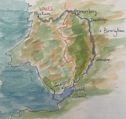
The river Severn takes its source in Plynlimon, Wales, at an altitude of 610 meters and ends at the Bristol channel. Moving against the river's flow, adult Atlantic salmon religiously migrate to the upper Severn to reproduce. Amazingly, they navigate back to the exact river and tributary they spawned from using the Earth's magnetic field and their memory of their birth river's scent. The journey upstream is nothing short of an olympic effort battling the Severn's currents, weirs and locks. Only the fittest salmon overcome these obstacles to reach their breeding grounds called the "redds" which are a shallow, gravelly river bed habitat.
Unfortunately the number of salmon making this trip every summer has fallen from 200K in the 1970s to 50K in 2020 across the UK. The reasons are two fold: fewer salmon are reaching our river mouths, and those that do are greeted with polluted, warm river water.
What I struggle to understand is why we are not using small sensor devices to obtain real-time monitoring of river water quality after every farm. I am not saying that we should be using this to attack farmers, but it would be a great way to narrow down issues of pollution so we can help. Why is real time river health data not collected? Surely we have the technology for it, but perhaps not the funding.